

Route map
Stops shown in driving order with a straight line between them, for planning only — this is not a turn-by-turn route. Always check current road conditions before you travel.
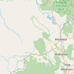
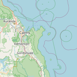
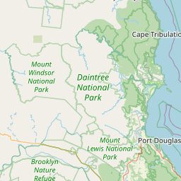
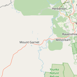
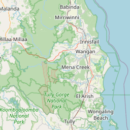



Route stops in order: 1. Cairns, 2. Undara Volcanic National Park, 3. Georgetown, 4. Normanton, 5. Burketown, 6. Hells Gate Roadhouse, 7. Borroloola, 8. Katherine, 9. Kununurra, 10. Broome.
Seasonal gate & outback safety
Check before you commit to dates- JJanuary — High risk / cut
- FFebruary — High risk / cut
- MMarch — High risk / cut
- AApril — High risk / cut
- MMay — Caution
- JJune — Open — go
- JJuly — Open — go
- AAugust — Open — go
- SSeptember — Open — go
- OOctober — Caution
- NNovember — High risk / cut
- DDecember — High risk / cut
- Open — go
- Caution
- High risk / cut
Dry-season route only. The Gulf sections between Normanton, Burketown, Hells Gate and Borroloola flood from roughly November to April and stay cut for weeks at a time. May and October are transition months — passable some years, closed others.
Wildlife warning: do not drive at night
Do not drive at night, at all, on this route. Unfenced cattle, brumbies, kangaroos, wild pigs and road trains share the road, and much of the Gulf has no coverage to call for help.
Live road conditions
The critical fact: the direct Gulf route between Burketown, Hells Gate and Borroloola includes long unsealed sections that are impassable in the wet and rough even in the dry. The sealed alternative drops south to the Barkly Highway and adds distance but takes any 2WD.
This is a dry-season-only trip. Roads across the Gulf country flood between roughly November and April and stay cut for weeks at a time. Do not plan this drive for the wet.
The stops, in driving order
- 01
Cairns
0 km in · StartCritical supply point — Last major city for tyres, servicing and spare parts until Katherine. Carry two spares from here.
The eastern end. Last major city with full vehicle servicing, tyre stock and spare parts until Katherine.
Tip: Get tyres, spare fuel and recovery gear sorted here. Prices and availability get worse and thinner the further west you go.
- 02
Undara Volcanic National Park
275 km in · 3h 30mLava tubes formed roughly 190,000 years ago — some of the longest on Earth. Access to the tubes is by guided tour only.
Tip: Tube tours must be booked ahead; you cannot walk into them independently.
- 03
Georgetown
415 km in · 1h 45mCritical supply point — Fuel and water. The gaps west of here get long.
Fuel, food and the Terrestrial mineral collection. Common overnight stop on the Gulf Developmental Road.
Tip: Fuel here even if you are not low. Gaps widen sharply west of Croydon.
- 04
Normanton & Karumba
700 km in · 3h 30mCritical supply point — Last reliable supermarket before the Gulf track. Fuel, water and food for several days.
Normanton has the Gulflander railway and the 8.63 m replica of Krys the crocodile. Karumba, 70 km further, is the only spot on this route where the sun sets over the Gulf water.
Tip: Every waterway here is croc country. No swimming, no cleaning fish at the water's edge, no camping right on the bank.
- 05
Burketown
930 km in · 2h 45mCritical supply point — Limited fuel and expensive. Top up regardless — the next reliable fuel is Hells Gate.
The decision point. West of here the direct route is unsealed. In September and October, Burketown is the best-known place on Earth to see the Morning Glory roll cloud.
Tip: Ask locally about the road to Hells Gate before committing — conditions change with each grading and each storm.
- 06
Hells Gate Roadhouse → Borroloola (NT)
1300 km in · Full day on unsealed roadCritical supply point — Critical fuel leg. Confirm Hells Gate is open and stocked before you commit — the next reliable fuel is Borroloola.
The remote heart of the route: unsealed, corrugated, with river crossings that can hold water into the early dry.
Tip: This is the section to skip if you are not in a properly equipped 4WD. The sealed Barkly Highway alternative is longer but safe in a 2WD.
- 07
Katherine (NT)
2050 km in · 1–2 days depending on routeCritical supply point — Full services return. Restock everything before the run west.
Regional hub with full services, and the gateway to Nitmiluk (Katherine Gorge) — thirteen gorges, best seen by canoe in the dry.
Tip: Nitmiluk canoe hire is dry-season only and the gorge closes to boats in the wet. Book ahead in July.
- 08
Kununurra (WA)
2560 km in · 5h 30m from KatherineFirst WA town, and the base for the Ord River and Purnululu (Bungle Bungles).
Tip: There is a quarantine checkpoint at the WA border — fresh fruit, vegetables, honey and nuts are confiscated. Eat or bin them before you get there. WA is also 90 minutes behind the NT.
- 09
Broome (WA)
3700 km in · 2 days via the Great Northern HighwayThe western end. Cable Beach, the pearling history, and the Staircase to the Moon on certain full-moon nights between roughly March and October.
Tip: Staircase to the Moon only happens on specific dates each month — check the published dates before planning around it.
Drive planning: legs, fuel and conditions
Three paces, same road: highway pace, a towing or 4WD rig, and what the day actually takes once fatigue and photo stops are in it.
| Leg | Distance | Standard vehicleHighway pace, no stops | Towing / 4WD rig90–100 km/h cruise | Realistic paceFatigue + photo stops | Fuel |
|---|---|---|---|---|---|
| Cairns → Georgetown | 415 km | 5h | 6h | 6h 20m | Mareeba, Mt Garnet, Georgetown |
| Georgetown → Normanton | 300 km | 3h 30m | 4h 10m | 4h 20m | Croydon, Normanton |
| Normanton → Burketown | 230 km | 2h 45m | 3h 20m | 3h 30m | Burketown |
| Burketown → Hells Gate | 300 km | 5–6h | 7h 10m | 7h 45m | Hells Gate Roadhouse only |
| Hells Gate → Borroloola | 270 km | 5–7h | 8h 25m | 8h 55m | Borroloola |
| Borroloola → Katherine | 670 km | 8h | 9h 35m | 10h 20m | Cape Crawford, Daly Waters, Mataranka |
| Katherine → Kununurra | 510 km | 5h 30m | 6h 35m | 6h 55m | Timber Creek |
| Kununurra → Broome | 1,040 km | 2 days | — | — | Halls Creek, Fitzroy Crossing |
| Whole route | 37h 45m | 45h 20m | 48h 5m | ||
How we get these: standard is moving time at signposted highway pace. Rig time assumes a 90–100 km/h cruise and slower acceleration — roughly 20% longer. Realistic pace adds a 15-minute fatigue stop every two hours (the national driver-fatigue guidance) plus about ten minutes an hour for photos, fuel and legs. Plan daylight around the realistic column, not the standard one.
| Leg | Distance | Fuel | Notes |
|---|---|---|---|
| Cairns → Georgetown | 415 km | Mareeba, Mt Garnet, Georgetown | Sealed. Steep Kuranda range climb out of Cairns |
| Georgetown → Normanton | 300 km | Croydon, Normanton | Sealed but single-lane bitumen in places — give way to road trains |
| Normanton → Burketown | 230 km | Burketown | Mostly sealed; the last stretch varies |
| Burketown → Hells Gate | 300 km | Hells Gate Roadhouse only | UNSEALED. 4WD, two spares, dry season only |
| Hells Gate → Borroloola | 270 km | Borroloola | UNSEALED, corrugated, creek crossings |
| Borroloola → Katherine | 670 km | Cape Crawford, Daly Waters, Mataranka | Carpentaria and Stuart Highways — sealed |
| Katherine → Kununurra | 510 km | Timber Creek | Sealed. Quarantine check and 1.5h time change at the WA border |
| Kununurra → Broome | 1,040 km | Halls Creek, Fitzroy Crossing | Sealed Great Northern Highway; long empty stretches |
What can go wrong
- Wet season closes this route. Between November and April, Gulf roads flood and can stay cut for weeks. Plan for May–September and check road conditions daily.
- Estuarine crocodiles inhabit every river, creek, billabong and coastal waterway across the Gulf and the Top End — including water that looks too small or too far inland. Do not swim, do not stand at the edge, do not clean fish there, and camp at least 50 m back from the bank.
- Fuel gaps on the direct Gulf route exceed 300 km with roadhouses that keep limited hours and occasionally run dry. Carry jerry cans and never pass a roadhouse assuming the next one is open.
- Road trains up to 53.5 m operate on these highways. On single-lane bitumen, pull fully off onto the shoulder and stop as they pass — do not try to share the seal.
- Coverage is Telstra-only across most of this route and absent entirely on the unsealed sections. Carry a satellite messenger or EPIRB; a mobile phone is not a safety plan out here.
Conditions change seasonally and after storms. Check current conditions with the road authority before relying on any of this.
Common questions
Where this is researched from
- Queensland Traffic (QLDTraffic) and NT Road Report — Live road closures and unsealed-road condition reports
- Department of Primary Industries and Regional Development WA — Border quarantine rules on fruit, vegetables, honey and nuts
This is a researched guide, not a firsthand trip report. How we research.
Spotted something we should update? Let us know.