

Route map
Stops shown in driving order with a straight line between them, for planning only — this is not a turn-by-turn route. Always check current road conditions before you travel.
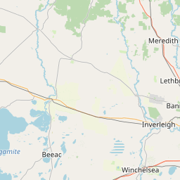
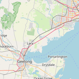
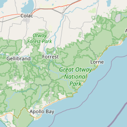
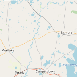
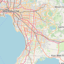
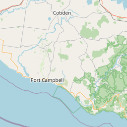
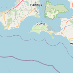
Route stops in order: 1. Torquay, 2. Aireys Inlet, 3. Lorne, 4. Kennett River, 5. Apollo Bay, 6. Cape Otway, 7. Port Campbell National Park, 8. Warrnambool.
Seasonal gate & outback safety
Check before you commit to dates- JJanuary — Caution
- FFebruary — Caution
- MMarch — Open — go
- AApril — Open — go
- MMay — Open — go
- JJune — Caution
- JJuly — Caution
- AAugust — Caution
- SSeptember — Open — go
- OOctober — Open — go
- NNovember — Open — go
- DDecember — Caution
- Open — go
- Caution
- High risk / cut
Open year-round. Amber months are crowding and weather, not closure — January is peak holiday gridlock, June to August brings short daylight, rain and fog through the Otways.
Wildlife warning: do not drive at night
Do not drive the Otways or Kennett River sections after dark. Kangaroos, wallabies and koalas move onto the road from dusk, and there are no shoulders to swerve into on the cliff sections.
Live road conditions
The single biggest planning mistake is treating 243 km as a three-hour drive. With stops, the honest figure is 6–8 hours of daylight one way, and the Twelve Apostles are 190 km in — arrive from Melbourne at 4pm in winter and you will photograph them in the dark.
Drive it west (Torquay first). The lookouts are on the ocean side heading that way, so every stop is a left turn instead of a cross-traffic turn.
The stops, in driving order
- 01
Torquay
0 km in · 1h 20m from Melbourne CBDCritical supply point — Last cheap fuel and full supermarket before Apollo Bay. Fill here.
Official start and the last big supermarket and cheap fuel before Apollo Bay. Bells Beach is a 10-minute detour south.
Tip: Fill up here. Fuel between Lorne and Port Campbell runs 15–25c/L higher.
- 02
Aireys Inlet (Split Point Lighthouse)
33 km in · 25 minThe white lighthouse on the headland with a free clifftop walk. Better light and far fewer people than the Apostles.
Tip: Free parking on Federal St fills by 10am on weekends; the Painkalac Creek car park is 300 m further and usually open.
- 03
Lorne
45 km in · 15 minThe main food-and-coffee stop of the eastern half, plus Erskine Falls 10 km inland (sealed road, 250-odd steps to the base).
Tip: Erskine Falls is a 30-minute round trip from the highway plus walking time — budget an hour, not 15 minutes.
- 04
Kennett River
65 km in · 25 minThe most reliable wild koala sighting on the route — Grey River Road, in the manna gums, first 1 km.
Tip: Go early morning or late afternoon and look up slowly. Do not feed the king parrots from your hand; it is bad for them and there are signs asking you not to.
- 05
Apollo Bay
90 km in · 35 minCritical supply point — Last full supermarket, medical centre and reliable coverage before Port Campbell. Fuel and water up.
The natural overnight point. Last town with a full supermarket, medical centre and reliable phone coverage before Port Campbell.
Tip: If you only have two days, sleep here — not at the Apostles end. It splits the drive time roughly evenly.
- 06
Cape Otway / Otway Ranges
112 km in · 25 min plus 12 km each way off-highwayCape Otway Lightstation (paid entry, mainland Australia's oldest surviving lighthouse) and the Otway rainforest — Maits Rest is a free 30-minute boardwalk loop right off the highway.
Tip: Maits Rest costs nothing and takes 30 minutes. If you are short on time, do that and skip the Lightstation detour.
- 07
Port Campbell National Park (Twelve Apostles)
190 km in · 1h 20mThe limestone stacks. Also Gibson Steps, Loch Ard Gorge and The Arch within 10 km — Loch Ard Gorge is the better walk and half the crowd.
Tip: Sunrise or the last hour of light. Tour buses run roughly 10am–3pm; outside that window the car park is manageable.
- 08
Warrnambool
243 km in · 50 minEnd of the road. Between roughly June and September southern right whales calve off Logans Beach — there is a viewing platform, and sightings are genuinely seasonal, not guaranteed.
Tip: From Warrnambool the inland A1 back to Melbourne takes about 3 hours — much faster than retracing the coast.
Drive planning: legs, fuel and conditions
Three paces, same road: highway pace, a towing or 4WD rig, and what the day actually takes once fatigue and photo stops are in it.
| Leg | Distance | Standard vehicleHighway pace, no stops | Towing / 4WD rig90–100 km/h cruise | Realistic paceFatigue + photo stops | Fuel |
|---|---|---|---|---|---|
| Melbourne → Torquay | 104 km | 1h 20m | 1h 35m | 1h 35m | Plentiful |
| Torquay → Lorne | 45 km | 45m | 55m | 55m | Anglesea, Lorne |
| Lorne → Apollo Bay | 45 km | 50m | 1h | 1h | Apollo Bay |
| Apollo Bay → Port Campbell | 100 km | 1h 40m | 2h | 1h 55m | Lavers Hill (limited hours) |
| Port Campbell → Warrnambool | 53 km | 50m | 1h | 1h | Port Campbell, Peterborough |
| Warrnambool → Melbourne (inland) | 263 km | 3h | 3h 35m | 3h 45m | Camperdown, Colac |
| Whole route | 8h 25m | 10h 5m | 10h 5m | ||
How we get these: standard is moving time at signposted highway pace. Rig time assumes a 90–100 km/h cruise and slower acceleration — roughly 20% longer. Realistic pace adds a 15-minute fatigue stop every two hours (the national driver-fatigue guidance) plus about ten minutes an hour for photos, fuel and legs. Plan daylight around the realistic column, not the standard one.
| Leg | Distance | Fuel | Notes |
|---|---|---|---|
| Melbourne → Torquay | 104 km | Plentiful | M1 freeway, no coastal driving yet |
| Torquay → Lorne | 45 km | Anglesea, Lorne | Curves start after Aireys Inlet |
| Lorne → Apollo Bay | 45 km | Apollo Bay | Tightest, slowest section — 40–60 km/h much of the way |
| Apollo Bay → Port Campbell | 100 km | Lavers Hill (limited hours) | Road turns inland through the Otways; patchy phone coverage |
| Port Campbell → Warrnambool | 53 km | Port Campbell, Peterborough | Open farmland, faster going |
| Warrnambool → Melbourne (inland) | 263 km | Camperdown, Colac | A1 Princes Highway — the sensible return leg |
What can go wrong
- Overtaking lanes are rare between Lorne and Apollo Bay. If three cars stack up behind you, use a signposted turnout — it is a legal requirement in Victoria to keep left and let faster traffic pass.
- Phone coverage drops out through the Otways between Apollo Bay and Lavers Hill. Download offline maps before you leave Apollo Bay.
- Kangaroos and wallabies are active at dawn and dusk along the Otway sections. Avoid driving this stretch in the hour either side of sunset.
- Cliff edges at the Apostles viewing areas are undercut and unfenced in places outside the boardwalks. Stay behind the barriers — people have died going over.
Conditions change seasonally and after storms. Check current conditions with the road authority before relying on any of this.
Common questions
Where this is researched from
- Great Ocean Road Coast and Parks Authority — Car park closures, cliff and beach access notices
- VicTraffic (Department of Transport and Planning) — Live closures — the road closes for landslips after heavy rain
This is a researched guide, not a firsthand trip report. How we research.
Spotted something we should update? Let us know.